
A recent survey conducted by the Forestry Commission has painted a grim picture of the escalating battle against illegal mining, popularly known as galamsey.
According to the report, the footprint of destruction within protected forest reserves has more than doubled in just three years.
In 2021, the affected area stood at 5,252.9 hectares.
By December 31, 2024, that figure had surged to 8,923.8 hectares, a staggering increase that highlights the persistent pressure on the nation’s “green lungs.”
The data, presented by Dr. Ben Torgbor, Operations Manager at the Plantations Department of the Forest Services Division, breaks down the devastation by region.
 Dr. Ben Torgbor, Operations Manager at the Plantations Department of the Forest Services Division
The Ashanti Region has emerged as the epicenter of this environmental crisis, accounting for more than half of the total recorded damage.
Conversely, the Savanna and Central regions remain the least impacted, though officials warn that no area is entirely immune to the lure of illegal gold.
The survey identified specific “hotspots” where the ecological integrity of the land is most at risk.
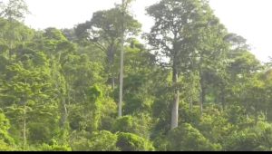
The most severely impacted forests include Oda River Forest Reserve (Ashanti Region), Apamprama Forest Reserve (Ashanti Region) and
Upper Wassaw Forest Reserve (Western North Region).
These areas, once thick with ancient canopies and biodiversity, are being transformed into landscapes of craters and silt-laden water bodies.
”The numbers represent more than just land; they represent lost ecosystems, threatened water sources, and a challenge to our future climate resilience.”
The surge to nearly 9,000 hectares of degraded forest land serves as a wake-up call for stakeholders.
As the Forestry Commission continues to monitor these “red zones,” the focus now shifts to how the state will intensify its reclamation efforts and enforcement to prevent these figures from climbing further in 2025.
By 1960news.com

